Optimize resources. Mitigate risk. Future-proof your O&M.
Vegetation management is many utilities’ greatest operations and maintenance expense, yet it's often under resourced with advanced tech. With more extreme weather, rising costs, catastrophic wildfires, and unplanned outages, it’s becoming more expensive and dangerous for vegetation management teams to provide less reliable power.
Overstory brings predictability, accountability, and cost savings to vegetation management programs at IOUs, municipalities, and cooperatives alike, helping you improve reliability, mitigate critical risks, and optimize resources across your whole network.
Top 4 ways utilities use Overstory’s vegetation intelligence
Cycle optimization
Determine when circuits should be trimmed to optimally improve reliability. If you can’t make it to all the circuits in your cycle, choose the ones most likely to improve your reliability.
Work quantification
Add transparency of volume, type, and location of work to bid packages, both internally and for potential external bidders, to get more accurate (and a higher volume of) bids.
Targeted risk identification
Identify risky conditions on circuits that may need to be addressed out of cycle. See strike trees, declining trees, and hazard trees individually or aggregated. Eliminate risky individual trees or combine with other work before an outage occurs.
Reporting and auditing
Measure and monitor changes in risk (reduction or increase) across your network between scans. Use risk reports to facilitate data-driven conversations with regulators, insurers, and executives.
See Overstory in action
Overstory gives you accurate vegetation risk analysis to help you make more informed decisions at the span and circuit level about your risk, reliability and O&M budget.
Why data-driven vegetation management matters
Rising expenses
Vegetation management expenses grew from 50% of overhead maintenance budgets in 2015 to 75% in 2020 and continue to rise.
Less labor availability
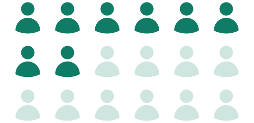
54.4% of workers in vegetation management voluntarily left their positions in the last five years, and the workforce is aging.
Extreme weather
Weather-related outages have increased by 78% over the last 10 years. “Outlier” days are
increasingly common.

Results
46%
Efficiency improvement including SAIDI and cost reduction for US distribution customer
64%
Trimming efficiency improvement for US transmission customer
13x
Return on investment for US transmission customer
“Every single hot spot that Overstory recommended we trim has needed work.”
— Josh Holland, Construction Engineering and Operations Director, Sho-Me Power Electric Cooperative
How vegetation intelligence can support your program
-
Use Overstory’s analysis to make informed decisions about where to save budget or improve reliability by pushing or pulling spans into or out of your trim cycle.
-
Verify spans with no apparent vegetation risk to save time and money spent sending contractors into the field.
-
Overlay encroachment risk, hazard trees, and species identification over wildfire risk maps to understand where trimming is most critical. Demonstrate informed risk prioritization to insurers, regulators, and community stakeholders in wildfire mitigation plans.
-
Define a High-Reliability Zone (HRZ) from each substation to the first protective device to target a limited number of high-impact hazard trees for removal.
-
Evaluate compliance throughout your network with each tree categorized by its encroachment risk.
-
Determine which work types need to be performed in certain areas: herbicide, mow, cut, and side-trim. Increase transparency internally and with contractors for bidding and resource planning.
-
Use our risk scores to confirm work has been completed and identify areas to revisit. Verify and document risk reduction from work completed. Drive performance improvements across contractors.
-
Quickly spot trees likely to cause outages in advance of extreme weather events. Share span- and circuit-level data with contractors to quickly take action in time-sensitive situations.
How our technology works
We create vegetation data by combining AI with remote sensing sources like satellite and aerial imagery.
Then we combine that data with important local information like asset location, wildfire maps, terrain, and more.
And we use vegetation intelligence to help utilities build efficient, data-driven vegetation management programs.
“It is not often you enter a partnership that honors true communications. I applaud Overstory for listening to its clients as we both have the same goal: we serve the public in the most efficient cost-effective way possible.”
— Mark Moreno, Vice President of Reliability and Field Engineering, Central Virginia Electric Cooperative
Book a demo
Ready to see what Overstory can do for your network? Get in touch.


