Wildfire mitigation — protecting people, property and the planet

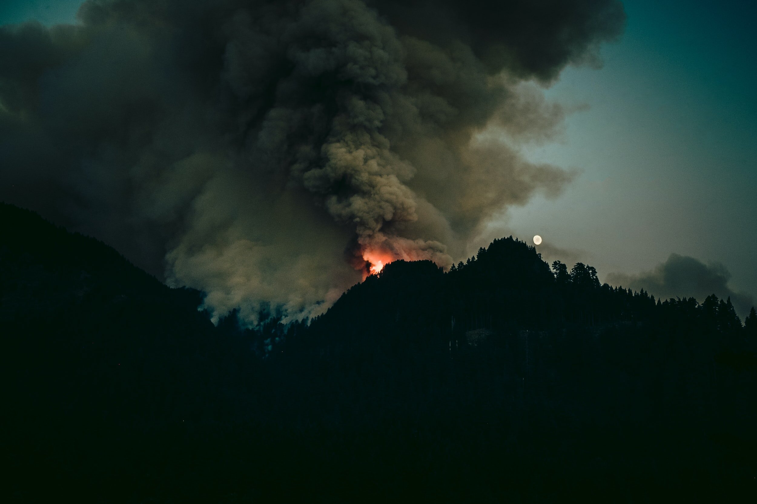
Wildfires in California, August 20, 2020
At the time of writing, devastating wildfires are coursing through California. It is a complex phenomenon that is growing in frequency, speed and intensity. California is not the only state suffering from the effects of climate change. Many states are currently reporting large wildfires.
Also in the past wildfires have affected different states. Colorado’s devastating Waldo Canyon wildfire burned for 17 days in 2012, costing approximately $500 million in damages, and the Texas wildfires of 2011 consumed 4 million acres and destroyed nearly 3,000 homes. In addition to rising temperatures, increased urbanization of naturally forested areas across the globe further contributes to the ignition, fuel load and fire spread of these wildfires.
Utilities are feeling the heat of this conflict more than most. Some of the most damaging forest fires in recent years have been linked to vegetation falling on power lines or faulty equipment igniting nearby vegetation. In a landmark case, the Californian utility giant Pacific Gas and Electric (PG&E) agreed a $13.5 billion settlement with victims over four separate wildfires.
Wildfire mitigation plans are now mandatory for utilities operating in California. With other states and countries looking set to follow close behind, below we explore the challenges utilities face, some of the strategies instrumental to reduce wildfire risk and how data can help drive this.

Wildfires in California captured by Sentinel-2, August 20, 2020
Facing the wildland-urban interface
80% of all wild species and plants are found in forests. These ecosystems are relied upon for medicine, wood-based products, as well as important carbon capture functions. At the same time, growing populations are pushing urbanization further into natural areas at a rate of 4,000 acres a day in North America. Power lines often extend from the boundaries of these wildland-urban interfaces, reaching into forests and connecting communities.
Where vegetation meets transmission lines, falling trees can damage cables and faulty equipment can ignite dry vegetation. This interface is being seen as the biggest risk for large scale forest fires in many regions. Fires not only damage property and endanger lives, but they also destroy precious habitats and contribute to climate change, removing carbon sinks and further contributing to hot, dry conditions that allow forest fires to spread.
Vegetation data to inform decisions

Due to the scale and frequency of power line related forest fires, utilities are now required by law in the State of California to submit annual wildfire mitigation plans. These are typically several hundred-page long documents that outline in detail the measures the company will take to prevent, combat and respond to wildfires within the territory of service. This includes mapping recent, modelled and baseline weather conditions, identifying public safety power shutoff (PSPS) zones and the locations for planned additions or removals of utility equipment.
While other fire-prone states may follow California’s mandatory lead, many utilities across the world are proactively planning their own mitigation strategies to reduce wildfire risk, covering a range of preventative measures and focused on high-risk areas. A crucial part of wildfire mitigation is information. Utilities are working with research institutes like EPRI and government bodies such as the California Department of Forestry and Fire Protection, as well as third-party data providers to exchange knowledge and collaborate to address this important issue.
Knowledge of risk and potential impact is the basis for informed decisions when it comes to managing the transmission and distribution right-of-way. This starts with a deep understanding of the surrounding vegetation. By knowing the species, canopy cover, density, height and proximity of vegetation, predictive trimming schedules can be employed that are focused on the greatest risk. Where unexpected changes occur, such as diseased or dying trees or storm damage, hotspots can be identified allowing immediate action to be taken. Alongside analysing data on the risk of forest fires, data helps to estimate the potential impact on a territory if a fire were to occur. What is the impact if a fire would occur in the region? Data-driven information on fuel loads, dryness of the undergrowth, fragmentation of the landscape and population are just some of the relevant factors to take into account, which helps to build a picture of what could happen after ignition.
Combining different data sources for predictive modelling
Imagery is crucial to this task. In recent years, LiDAR data gathered by helicopters, aerial data from drones or airplanes have brought detailed local data on encroachment. The addition of satellite & AI-based technology is enabling a more frequent and a holistic view on vegetation to operators of transmission and distribution grids. Frequent data at scale is needed to create, iterate and validate predictive models. It is not only important to perceive the vegetation in real-time, but also to predict the growth of trees and the change in vitality. This predictive vegetation intelligence leads to the third “layer” of intelligence: prescriptive data.
When imagery is layered and combined with other big data sets, such as weather forecasts and historical fire data, patterns emerge. By using artificial intelligence to mine a vast amount of data layers, a detailed picture can be built of the land surrounding power lines. With this insight, utilities can direct their efforts to areas most at risk and direct trimming and maintenance when and where it is needed.
With prescriptive insights, utilities can direct their efforts to areas most at risk and direct trimming and maintenance when and where it is needed. Safety measures, such as PSPS can be directed where models predict a serious and imminent threat, such as falling trees or severe storm conditions. Although PSPS is a last resort, no utility company wants to leave homes and businesses without power, it is an effective tool in the fight against forest fires when used at the right time. In time, as vegetation management becomes more risk-based and is built on greater data intelligence, intervention through PSPS could become less frequent and blackouts could become shorter.
Towards solving the complex wildfire problem
Predictive modelling is one piece of wildfire mitigation. Its role is to help electric utilities to control and minimize risk and impact. It’s about directing resources to where it is needed, trimming when and where necessary to protect power lines and recognizing where danger points are occurring well before a fire starts. The problem is highly complex, involves multiple stakeholders and won’t be solved overnight. Detailed data on vegetation and the landscape is becoming a key instrument in preventing power-related forest fires, protecting people, property and the natural forests that we depend upon.